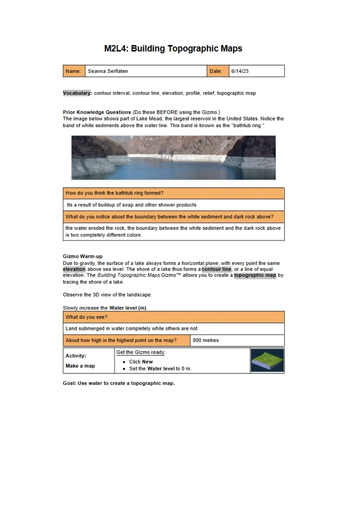
 M2L4: Building Topographic MapsNameSeanna SerflatenDate:6/14/23Vocabulary: contour interval, contour line, elevation, profile, relief, topographic mapPrior Knowledge Questions (Do lhese BEFORE using lhe Gizmo.)The image below shows part of Lake Mead, lhe largest reservoir in lhe United States. Nolice lheband of while sediments above lhe water line. This band is known as the "balhtub ring.'How do you think lhe bathtub ring formed?Its a result of buildup of soap and other shower productsWhat do you notice about the boundary between the white sediment and dark rock above?the waler eroded lhe rock, lhe boundary between the white sediment and the dark rock aboveis two completely different colors.Gizmo Warm-upDue to gravity, lhe surface of a lake always forms a horizontal plane, wilh every poinl lhe sameelevation above sea level. The shore of a lake thus forms acontour line, or a line of equalelevation. TheBuilding TopographicMaps Gizmo"1" allows you Io create a topographic map bytracing lhe shore of a lake.Observe lhe 3D view of lhe landscapeSlowly increase lhe Water level (m).What do you see?Land submerged in water completely while others are nolAbout how high is the highest poinl on the map?9D0 metresActivity:Make a mapGel lhe Gizmo ready:•Click New.■Sei lhe Water level Io 0 m.Goal: Use water to create a topographic map.
Preview Mode
This document has 6 pages. Sign in to access the full document!