

Test Bank for Elemental Geosystems, 9th Edition
- Electrical Engineering & Electronics
- 750 pages
- Shared May 2025
Boost your study sessions with Test Bank for Elemental Geosystems, 9th Edition, a practical guide featuring exam questions and answers.
Preview 16 of 750 pages
See the first 16 pages exactly as they appear in the document.
Page 1 Read page 1 as text
1 Elemental Geosystems, 9e (Christopherson/Birkeland) Chapter 1 Essentials of Geography 1) A physical geographer would likely NOT study A) the impact of a hurricane's landfall along the U.S. East Coast. B) where pollutants move in the atmosphere. C) the 2 015 earthquake in Nepal. D) the spread of various religions. Answer: D Chapter/Section: 1.1 The Science of Geography Bloom's Taxonomy: 1/2 Knowledge/Comprehension Geo Standard: 01. How to use maps and other geographic representations, geospatial techno logies, and spatial thinking to understand and communicate information. Global Sci. LO: 7. Demonstrate the ability to make connections across geography. LO: 1.1 Define geography and physical geography. 2) Geography is different from other sciences such as geology and biology because it is A) an Earth science. B) a human science. C) a physical science. D) a spatial science. Answer: D Chapter/Section: 1.1 The Science of Geography Bloom's Taxonomy: 1/2 Knowledge/Comprehension Geo Standard: 01. How to us e maps and other geographic representations, geospatial technologies, and spatial thinking to understand and communicate information. Global Sci. LO: 7. Demonstrate the ability to make connections across geography. LO: 1.1 Define geography and physical g eography. 3) The word spatial refers to A) the nature and character of physical space and the distribution of phenomena within it. B) items that relate specifically to society. C) things that are unique and special. D) eras of time. Answer: A Chapter/Sec tion: 1.1 The Science of Geography Bloom's Taxonomy: 3/4 Application/Analysis Geo Standard: 01. How to use maps and other geographic representations, geospatial technologies, and spatial thinking to understand and communicate information. Global Sci. LO : 2. Demonstrate the ability to think critically and employ critical thinking skills. LO: 1.1 Define geography and physical geography.
Page 2 Page 3 Read page 3 as text
2 4) Which is NOT true of geographers? A) They are Earth systems scientists. B) They are primarily concerned with place names. C) They are concerned with spatial and temporal relationships. D) They use spatial analysis. Answer: B Chapter/Section: 1.1 The Science of Geography Bloom's Taxonomy: 3/4 Application/Analysis Geo Standard: 01. How to use maps and other geograph ic representations, geospatial technologies, and spatial thinking to understand and communicate information. Global Sci. LO: 2. Demonstrate the ability to think critically and employ critical thinking skills. LO: 1.1 Define geography and physical geograp hy. 5) Geography A) is not a science. B) does not use systems analysis. C) does not consider process in explaining systems. D) is derived from geo and graphein; literally, "to write Earth." Answer: D Chapter/Section: 1.1 The Science of Geography Bloom's Taxonomy: 3/4 Application/Analysis Geo Standard: 01. How to use maps and other geographic representations, geospatial technologies, and spatial thinking to understand and communicate information. Global Sci. LO: 7. Demonstrate the ability to make connec tions across geography. LO: 1.1 Define geography and physical geography. 6) "Geography" literally means A) place memorization. B) the study of rocks. C) map making. D) to write (about) Earth. Answer: D Chapter/Section: 1.1 The Science of Geography Bloo m's Taxonomy: 1/2 Knowledge/Comprehension Geo Standard: 01. How to use maps and other geographic representations, geospatial technologies, and spatial thinking to understand and communicate information. Global Sci. LO: 7. Demonstrate the ability to make connections across geography. LO: 1.1 Define geography and physical geography.
Page 4 Read page 4 as text
3 7) The main methodology governing geographic inquiry A) is behavioral analysis. B) involves spatial analysis. C) uses chronological organization. D) is field work. Answer: B Chapter/Section: 1.1 The Science of Geography Bloom's Taxonomy: 1/2 Knowledge/Comprehension Geo Standard: 01. How to use maps and other geographic representations, geospatial technologies, and spatial thinking to understand and communicate information . Global Sci. LO: 7. Demonstrate the ability to make connections across geography. LO: 1.1 Define geography and physical geography. 8) Which of the following best describes the field of physical geography? A) Understanding soil development B) Mapping of rock types C) The study of weather D) The spatial analysis of all the physical elements, processes, and systems that make up the environment Answer: D Chapter/Section: 1.1 The Science of Geography Bloom's Taxonomy: 1/2 Knowledge/Comprehension Geo Stand ard: 01. How to use maps and other geographic representations, geospatial technologies, and spatial thinking to understand and communicate information. Global Sci. LO: 7. Demonstrate the ability to make connections across geography. LO: 1.1 Define geogr aphy and physical geography. 9) Which of the following most accurately characterizes the goal of geography? A) The production of maps B) Memorization of the names of places on world and regional maps C) Memorization of the imports and exports of a country D) Understanding distributions and movements across Earth Answer: D Chapter/Section: 1.1 The Science of Geography Bloom's Taxonomy: 1/2 Knowledge/Comprehension Geo Standard: 01. How to use maps and other geographic representations, geospatial technolog ies, and spatial thinking to understand and communicate information. Global Sci. LO: 7. Demonstrate the ability to make connections across geography. LO: 1.1 Define geography and physical geography.
Page 5 Read page 5 as text
4 10) Geography is often divided into the two subfields of A) physical geography and human/cultural geography. B) physical geography and economic geography. C) economic geography and political geography. D) political geography and environmental geography. Answer: A Chapter/Section: 1.1 The Science of Geograp hy Bloom's Taxonomy: 1/2 Knowledge/Comprehension Geo Standard: 01. How to use maps and other geographic representations, geospatial technologies, and spatial thinking to understand and communicate information. Global Sci. LO: 7. Demonstrate the ability to make connections across geography. LO: 1.1 Define geography and physical geography. 11) Which of the following is NOT true of scientific theories? A) They are based on hypothesis testing. B) They are broad in scope because they unify known facts about the world. C) They are based on natural laws (such as those pertaining to gravity, relativity, atomic theory, etc.). D) They are absolute truths and can never be proven wrong. Answer: D Chapter/Section: 1.2 Earth Systems Concepts Bloom's Taxonomy: 1/2 Knowledge/Comprehension Geo Standard: 01. How to use maps and other geographic representations, geospatial technologies, and spatial thinking to understand and communicate information. Global Sci. LO: 1. Demonstrate an understanding of the principles of scientific inquiry. LO: 1.3 Summarize the scientific process. 12) The key idea behind the scientific method is A) the use of intuition in testing theories. B) an appeal to supernatural explanations when natural explanations have not yet been found for a phenomenon. C) the testing of ideas through controlled observations and experiments. D) unbridled speculation about the world. Answer: C Chapter/Section: 1.2 Earth Systems Concepts Bloom's Taxonomy: 1/2 Knowledge/Comprehension Geo Standard: 01. How to use maps and other geographic representations, geospatial technologies, and spatial thinking to understand and communicate information. Global Sci. LO: 1. Demonstrate an understanding of the principles of scientific inquiry. LO: 1.3 Summarize the scienti fic process.
Page 6 Read page 6 as text
5 13) The scientific method is described by which of the following? A) A single, definitive method for doing science B) The acceptance of supernatural explanations for phenomenon until science proves otherwise C) The development of hypotheses f or testing and prediction D) Irreproducible results accepted as theory Answer: C Chapter/Section: 1.2 Earth Systems Concepts Bloom's Taxonomy: 3/4 Application/Analysis Geo Standard: 01. How to use maps and other geographic representations, geospatial t echnologies, and spatial thinking to understand and communicate information. Global Sci. LO: 1. Demonstrate an understanding of the principles of scientific inquiry. LO: 1.3 Summarize the scientific process. 14) Which of the following is TRUE of human p opulation trends? A) Most of the growth in population is in the more developed countries (MDCs). B) World population reached 8 billion in 1999. C) World population reached 7 billion in 2012. D) 83% of the world lives in a more developed country (MDC). Answ er: C Chapter/Section: 1.1 The Science of Geography Bloom's Taxonomy: 1/2 Knowledge/Comprehension Geo Standard: 01. How to use maps and other geographic representations, geospatial technologies, and spatial thinking to understand and communicate inform ation. Global Sci. LO: 7. Demonstrate the ability to make connections across geography. LO: 1.4 Discuss human population growth as it relates to geographic science. 15) Which of the following is TRUE of human population trends? A) People in more develop ed countries (MDCs) have more impact per person than people in less developed countries (LDCs). B) 5% of the world's population lives in a less developed country (LDC). C) Almost all of the population growth is occurring in the more developed countries (MD Cs). D) 83% of the world lives in a more developed country (MDC). Answer: A Chapter/Section: 1.1 The Science of Geography Bloom's Taxonomy: 1/2 Knowledge/Comprehension Geo Standard: 01. How to use maps and other geographic representations, geospatial t echnologies, and spatial thinking to understand and communicate information. Global Sci. LO: 7. Demonstrate the ability to make connections across geography. LO: 1.4 Discuss human population growth as it relates to geographic science.
Page 7 Read page 7 as text
6 16) ________ is ma ss that assumes a physical shape and occupies space. A) Energy B) Entropy C) Matter D) A system Answer: C Chapter/Section: 1.1 The Science of Geography Bloom's Taxonomy: 1/2 Knowledge/Comprehension Geo Standard: 01. How to use maps and other geographic representations, geospatial technologies, and spatial thinking to understand and communicate information. Global Sci. LO: 7. Demonstrate the ability to make connections across geography. LO: 1.5 Describe open and closed systems, feedback, and equilibriu m concepts as they relate to Earth systems. 17) The capacity to change the motion of, or to do work on, matter is the definition of A) energy. B) plasma. C) thermodynamics. D) acceleration. E) system. Answer: A Chapter/Section: 1.2 Earth Systems Concept s Bloom's Taxonomy: 1/2 Knowledge/Comprehension Geo Standard: 01. How to use maps and other geographic representations, geospatial technologies, and spatial thinking to understand and communicate information. Global Sci. LO: 2. Demonstrate the ability t o think critically and employ critical thinking skills. LO: 1.5 Describe open and closed systems, feedback, and equilibrium concepts as they relate to Earth systems. 18) Which of the following is an example of a closed system? A) A forest B) A river drai nage basin C) An automobile D) Earth (in terms of matter) Answer: D Chapter/Section: 1.2 Earth Systems Concepts Bloom's Taxonomy: 1/2 Knowledge/Comprehension Geo Standard: 01. How to use maps and other geographic representations, geospatial technologie s, and spatial thinking to understand and communicate information. Global Sci. LO: 2. Demonstrate the ability to think critically and employ critical thinking skills. LO: 1.5 Describe open and closed systems, feedback, and equilibrium concepts as they re late to Earth systems.
Page 8 Read page 8 as text
7 19) In terms of matter and resources, Earth is essentially a(n) ________ system; In terms of energy, Earth is a(n) ________ system. A) closed; closed B) closed; open C) open; open D) open; closed Answer: B Chapter/Section: 1.2 Ear th Systems Concepts Bloom's Taxonomy: 3/4 Application/Analysis Geo Standard: 01. How to use maps and other geographic representations, geospatial technologies, and spatial thinking to understand and communicate information. Global Sci. LO: 2. Demonstrat e the ability to think critically and employ critical thinking skills. LO: 1.5 Describe open and closed systems, feedback, and equilibrium concepts as they relate to Earth systems. 20) Which of the following is INCORRECT? A) Earth represents a vast integ rated system. B) Earth represents an open system in terms of energy. C) Earth represents a closed system in terms of matter. D) Large amounts of new matter are being added to Earth's systems all the time. Answer: D Chapter/Section: 1.2 Earth Systems Conc epts Bloom's Taxonomy: 1/2 Knowledge/Comprehension Geo Standard: 01. How to use maps and other geographic representations, geospatial technologies, and spatial thinking to understand and communicate information. Global Sci. LO: 2. Demonstrate the abilit y to think critically and employ critical thinking skills. LO: 1.5 Describe open and closed systems, feedback, and equilibrium concepts as they relate to Earth systems. 21) Systems encountered in nature at Earth's surface, such as a forest, are A) open s ystems in terms of energy. B) closed systems in terms of energy. C) open systems in terms of matter. D) both open systems in terms of energy and open systems in terms of matter. E) both closed systems in terms of energy and open systems in terms of matter. Answer: D Chapter/Section: 1.2 Earth Systems Concepts Bloom's Taxonomy: 3/4 Application/Analysis Geo Standard: 01. How to use maps and other geographic representations, geospatial technologies, and spatial thinking to understand and communicate inform ation. Global Sci. LO: 2. Demonstrate the ability to think critically and employ critical thinking skills. LO: 1.5 Describe open and closed systems, feedback, and equilibrium concepts as they relate to Earth systems.
Page 9 Read page 9 as text
8 22) With respect to air, water, and material resources, which of the following is TRUE? A) A forest is a closed system. B) A forest is an open system. C) A forest is an open system in terms of air, but closed in terms of material resources. D) A forest is an open system in terms of water, bu t closed in terms of energy resources. Answer: B Chapter/Section: 1.2 Earth Systems Concepts Bloom's Taxonomy: 1/2 Knowledge/Comprehension Geo Standard: 01. How to use maps and other geographic representations, geospatial technologies, and spatial thin king to understand and communicate information. Global Sci. LO: 2. Demonstrate the ability to think critically and employ critical thinking skills. LO: 1.5 Describe open and closed systems, feedback, and equilibrium concepts as they relate to Earth syste ms. 23) What type of feedback maintains stability in a system; i.e., what type of feedback keeps a system functioning properly? A) Positive B) Negative C) Neutral Answer: B Chapter/Section: 1.2 Earth Systems Concepts Bloom's Taxonomy: 3/4 Application/A nalysis Geo Standard: 01. How to use maps and other geographic representations, geospatial technologies, and spatial thinking to understand and communicate information. Global Sci. LO: 2. Demonstrate the ability to think critically and employ critical th inking skills. LO: 1.5 Describe open and closed systems, feedback, and equilibrium concepts as they relate to Earth systems. 24) Which type of feedback encourages change in a system? A) Positive B) Negative C) Neutral D) Not enough information is given t o indicate what type of feedback has occurred. Answer: A Chapter/Section: 1.2 Earth Systems Concepts Bloom's Taxonomy: 3/4 Application/Analysis Geo Standard: 01. How to use maps and other geographic representations, geospatial technologies, and spatial thinking to understand and communicate information. Global Sci. LO: 2. Demonstrate the ability to think critically and employ critical thinking skills. LO: 1.5 Describe open and closed systems, feedback, and equilibrium concepts as they relate to Earth systems.
Page 10 Read page 10 as text
9 25) Which of the following is CORRECTLY matched? A) Threshold — balance of inputs and outputs B) Steady state equilibrium — feedback encourages change C) Dynamic equilibrium — large fluctuations that change abruptly over time D) Tipping point — same as s teady state equilibrium Answer: B Chapter/Section: 1.2 Earth Systems Concepts Bloom's Taxonomy: 3/4 Application/Analysis Geo Standard: 01. How to use maps and other geographic representations, geospatial technologies, and spatial thinking to understand and communicate information. Global Sci. LO: 2. Demonstrate the ability to think critically and employ critical thinking skills. LO: 1.5 Describe open and closed systems, feedback, and equilibrium concepts as they relate to Earth systems. 26) Which of the following best describes the condition of steady - state equilibrium? A) System inputs always exactly balance outputs so the system never changes. B) System inputs and outputs fluctuate around a stable average so the system does not move far from its ave rage condition. C) System inputs produce large, random fluctuations in output, forcing the system into a new state of equilibrium. D) Systems slowly adjust to long - term changes in input and output. Answer: B Chapter/Section: 1.2 Earth Systems Concepts Bl oom's Taxonomy: 3/4 Application/Analysis Geo Standard: 01. How to use maps and other geographic representations, geospatial technologies, and spatial thinking to understand and communicate information. Global Sci. LO: 2. Demonstrate the ability to think critically and employ critical thinking skills. LO: 1.5 Describe open and closed systems, feedback, and equilibrium concepts as they relate to Earth systems. 27) As arctic temperatures rise, summer sea ice and glacial melt accelerates; lighter color sur faces are thereby replaced with darker - colored surfaces leading to more absorption and surface heating. This is an example of a(n) ________ feedback. A) negative B) positive C) reverse D) dynamic Answer: B Chapter/Section: 1.2 Earth Systems Concepts Bloo m's Taxonomy: 3/4 Application/Analysis Geo Standard: 01. How to use maps and other geographic representations, geospatial technologies, and spatial thinking to understand and communicate information. Global Sci. LO: 2. Demonstrate the ability to think c ritically and employ critical thinking skills. LO: 1.5 Describe open and closed systems, feedback, and equilibrium concepts as they relate to Earth systems.
Page 11 Read page 11 as text
10 28) If increased levels of carbon dioxide lead to further increases in temperature by promoting th e release of even more carbon dioxide from the oceans, this means that ________ feedback has occurred and that the planet is ________. A) positive; in equilibrium B) positive; out of equilibrium C) negative; in equilibrium D) negative; out of equilibrium A nswer: B Chapter/Section: 1.2 Earth Systems Concepts Bloom's Taxonomy: 3/4 Application/Analysis Geo Standard: 01. How to use maps and other geographic representations, geospatial technologies, and spatial thinking to understand and communicate informat ion. Global Sci. LO: 2. Demonstrate the ability to think critically and employ critical thinking skills. LO: 1.5 Describe open and closed systems, feedback, and equilibrium concepts as they relate to Earth systems. 29) The carbon dioxide absorbed by pla nts is an example of an ________ to a forest and an ________ from the atmosphere. A) input; input B) input; output C) output; output D) output; input Answer: B Chapter/Section: 1.2 Earth Systems Concepts Bloom's Taxonomy: 3/4 Application/Analysis Geo St andard: 01. How to use maps and other geographic representations, geospatial technologies, and spatial thinking to understand and communicate information. Global Sci. LO: 2. Demonstrate the ability to think critically and employ critical thinking skills. LO: 1.5 Describe open and closed systems, feedback, and equilibrium concepts as they relate to Earth systems. 30) A large flood in a river may cause abrupt shifts leading to the carving of a new channel. The point when change occurs is a(n) A) type of d ynamic equilibrium condition. B) type of metastable equilibrium. C) threshold. D) input. Answer: C Chapter/Section: 1.2 Earth Systems Concepts Bloom's Taxonomy: 3/4 Application/Analysis Geo Standard: 01. How to use maps and other geographic representat ions, geospatial technologies, and spatial thinking to understand and communicate information. Global Sci. LO: 2. Demonstrate the ability to think critically and employ critical thinking skills. LO: 1.5 Describe open and closed systems, feedback, and equ ilibrium concepts as they relate to Earth systems.
Page 12 Read page 12 as text
11 31) If global temperatures increased and caused more water vapor to enter the air and more snow to fall in cooler latitudes, then the initial increase in snowfall would be a ________ feedback, whereas a su stained increase in the temperatures could lead to the loss of snow cover even at those latitudes and cause a ________ feedback. A) positive; positive B) positive; negative C) negative; positive D) negative; negative Answer: C Chapter/Section: 1.2 Earth Systems Concepts Bloom's Taxonomy: 3/4 Application/Analysis Geo Standard: 01. How to use maps and other geographic representations, geospatial technologies, and spatial thinking to understand and communicate information. Global Sci. LO: 2. Demonstrate t he ability to think critically and employ critical thinking skills. LO: 1.5 Describe open and closed systems, feedback, and equilibrium concepts as they relate to Earth systems. 32) Which of the following is TRUE of models? A) They complicate our underst anding of Earth system science. B) They perfectly replicate the real world, but at a different scale. C) They are simplified, idealized representations of the real world. D) They are never used in physical geography because of their inherent limitations. A nswer: C Chapter/Section: 1.1 The Science of Geography Bloom's Taxonomy: 1/2 Knowledge/Comprehension Geo Standard: 01. How to use maps and other geographic representations, geospatial technologies, and spatial thinking to understand and communicate inf ormation. Global Sci. LO: 2. Demonstrate the ability to think critically and employ critical thinking skills. LO: 1.5 Describe open and closed systems, feedback, and equilibrium concepts as they relate to Earth systems. 33) According to the text, the th ree inorganic Earth realms are the A) hydrosphere, lithosphere, and atmosphere. B) thermosphere, lithosphere, and heterosphere. C) atmosphere, geoid, and homosphere. D) stratosphere, magnetosphere, and troposphere. Answer: A Chapter/Section: 1.2 Earth Sy stems Concepts Bloom's Taxonomy: 1/2 Knowledge/Comprehension Geo Standard: 01. How to use maps and other geographic representations, geospatial technologies, and spatial thinking to understand and communicate information. Global Sci. LO: 2. Demonstrate the ability to think critically and employ critical thinking skills. LO: 1.1 Define geography and physical geography.
Page 13 Read page 13 as text
12 34) Living systems are called A) biotic. B) inorganic. C) part of the lithosphere. D) abiotic. Answer: A Chapter/Section: 1.2 Earth Sy stems Concepts Bloom's Taxonomy: 1/2 Knowledge/Comprehension Geo Standard: 01. How to use maps and other geographic representations, geospatial technologies, and spatial thinking to understand and communicate information. Global Sci. LO: 2. Demonstrate the ability to think critically and employ critical thinking skills. LO: 1.5 Describe open and closed systems, feedback, and equilibrium concepts as they relate to Earth systems. 35) Which of the following is TRUE of the biosphere? A) It is never referre d to as the ecosphere. B) It is static, never to rarely changing. C) It is not connected to the overlapping inorganic spheres. D) It extends from the floor of the oceans to 8 km (5 mi.) into the atmosphere. Answer: D Chapter/Section: 1.2 Earth Systems Co ncepts Bloom's Taxonomy: 1/2 Knowledge/Comprehension Geo Standard: 01. How to use maps and other geographic representations, geospatial technologies, and spatial thinking to understand and communicate information. Global Sci. LO: 2. Demonstrate the abil ity to think critically and employ critical thinking skills. LO: 1.1 Define geography and physical geography. 36) Which of the following is TRUE of the biosphere? A) It is more a hypothetical concept than an actual "sphere" in physical geography terms. B ) Life processes generally are shaped to the abiotic spheres. C) It is the least important of the four "spheres." D) It only occurs in the hydrosphere. Answer: B Chapter/Section: 1.2 Earth Systems Concepts Bloom's Taxonomy: 1/2 Knowledge/Comprehension G eo Standard: 01. How to use maps and other geographic representations, geospatial technologies, and spatial thinking to understand and communicate information. Global Sci. LO: 2. Demonstrate the ability to think critically and employ critical thinking sk ills. LO: 1.1 Define geography and physical geography.
Page 14 Read page 14 as text
13 37) The realization that Earth was a sphere A) did not occur in Europe until the first voyages of Columbus. B) had to wait until the modern era (1800s). C) was first made by Pythagoras, 580 — 500 B.C. D) was made by Isaac Newton. Answer: C Chapter/Section: 1.3 Location and Time on Earth Bloom's Taxonomy: 1/2 Knowledge/Comprehension Geo Standard: 01. How to use maps and other geographic representations, geospatial technologies, and spatial thinking to understand and communicate information. Global Sci. LO: 2. Demonstrate the ability to think critically and employ critical thinking skills. LO: 1.6 Explain Earth's shape and reference grid: latitude, longitude, latitudinal geographic zones, and time z ones. 38) Which of the following statements about Earth is CORRECT? A) It is elongated. B) Earth is the second largest planet in the solar system. C) The equatorial diameter is approximately 42 km (26 mi.) greater than the polar diameter. D) Earth is perfe ctly spherical. Answer: C Chapter/Section: 1.3 Location and Time on Earth Bloom's Taxonomy: 1/2 Knowledge/Comprehension Geo Standard: 01. How to use maps and other geographic representations, geospatial technologies, and spatial thinking to understand and communicate information. Global Sci. LO: 2. Demonstrate the ability to think critically and employ critical thinking skills. LO: 1.6 Explain Earth's shape and reference grid: latitude, longitude, latitudinal geographic zones, and time zones. 39) The oblateness of Earth occurs at the A) poles. B) equator. C) subtropics. D) prime meridian. Answer: A Chapter/Section: 1.3 Location and Time on Earth Bloom's Taxonomy: 1/2 Knowledge/Comprehension Geo Standard: 01. How to use maps and other geographic re presentations, geospatial technologies, and spatial thinking to understand and communicate information. Global Sci. LO: 2. Demonstrate the ability to think critically and employ critical thinking skills. LO: 1.6 Explain Earth's shape and reference grid: latitude, longitude, latitudinal geographic zones, and time zones.
Page 15 Read page 15 as text
14 40) The diameter of Earth is largest when measured around the A) poles. B) equator. C) subtropics. D) prime meridian. Answer: B Chapter/Section: 1.3 Location and Time on Earth Bloom's T axonomy: 1/2 Knowledge/Comprehension Geo Standard: 01. How to use maps and other geographic representations, geospatial technologies, and spatial thinking to understand and communicate information. Global Sci. LO: 2. Demonstrate the ability to think cri tically and employ critical thinking skills. LO: 1.6 Explain Earth's shape and reference grid: latitude, longitude, latitudinal geographic zones, and time zones. 41) Who divided the circumference of Earth into 360°, with each degree comprising 60 minutes, and each minute comprising 60 seconds. A) Pythagoras — in the sixth century B.C. B) Sir Isaac Newton — in the seventeenth century A.D. C) Magellan — in the sixteenth century A.D. D) Ptolemy — in the second century A.D. Answer: D Chapter/Section: 1.3 Location an d Time on Earth Bloom's Taxonomy: 1/2 Knowledge/Comprehension Geo Standard: 01. How to use maps and other geographic representations, geospatial technologies, and spatial thinking to understand and communicate information. Global Sci. LO: 2. Demonstrate the ability to think critically and employ critical thinking skills. LO: 1.6 Explain Earth's shape and reference grid: latitude, longitude, latitudinal geographic zones, and time zones. 42) A parallel of latitude A) is used to measure distances east and west of the prime meridian. B) measures longitude. C) is called a meridian. D) is used to measure distances north or south of the equator. E) is a line which passes through both poles. Answer: D Chapter/Section: 1.3 Location and Time on Earth Bloom's Ta xonomy: 1/2 Knowledge/Comprehension Geo Standard: 01. How to use maps and other geographic representations, geospatial technologies, and spatial thinking to understand and communicate information. Global Sci. LO: 2. Demonstrate the ability to think crit ically and employ critical thinking skills. LO: 1.6 Explain Earth's shape and reference grid: latitude, longitude, latitudinal geographic zones, and time zones.
Page 16 Read page 16 as text
15 43) The horizontal lines used to measure angles north and south are A) parallels of longi tude. B) parallels of latitude. C) zenith of longitude. D) meridians of latitude. Answer: B Chapter/Section: 1.3 Location and Time on Earth Bloom's Taxonomy: 1/2 Knowledge/Comprehension Geo Standard: 01. How to use maps and other geographic representat ions, geospatial technologies, and spatial thinking to understand and communicate information. Global Sci. LO: 2. Demonstrate the ability to think critically and employ critical thinking skills. LO: 1.6 Explain Earth's shape and reference grid: latitude, longitude, latitudinal geographic zones, and time zones. 44) An angular distance measured north or south of the equator is termed A) longitude. B) latitude. C) zenith. D) Greenwich distance. Answer: B Chapter/Section: 1.3 Location and Time on Earth Blo om's Taxonomy: 1/2 Knowledge/Comprehension Geo Standard: 01. How to use maps and other geographic representations, geospatial technologies, and spatial thinking to understand and communicate information. Global Sci. LO: 2. Demonstrate the ability to thi nk critically and employ critical thinking skills. LO: 1.6 Explain Earth's shape and reference grid: latitude, longitude, latitudinal geographic zones, and time zones.
734 more pages in the full document
Unlock it once and it stays in your library, ready to chat with or turn into flashcards.
Unlock the full documentMore Electrical Engineering & Electronics study materials
See all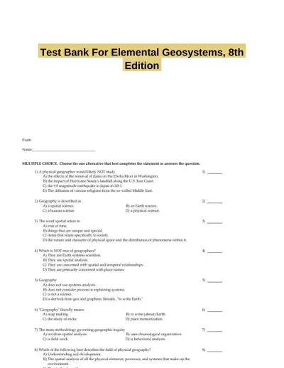 Exam Guides
Test Bank For Elemental Geosystems, 8th Edition
Electrical Engineering & Electronics
712 pagesMay 2025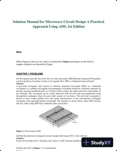 Textbook Guides
Solution Manual for Microwave Circuit Design A Practical Approach Using ADS, 1st Edition
Electrical Engineering & Electronics
121 pages154downloadsFeb 2025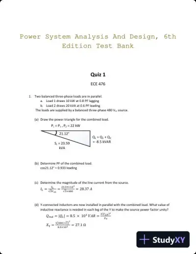 Exam Guides
Power System Analysis And Design, 6th Edition Test Bank
Electrical Engineering & Electronics
40 pages132downloadsFeb 2025 Textbook Guides
Solution Manual For Electronics Fundamentals: A Systems Approach, 1st Edition
Electrical Engineering & Electronics
278 pages93downloadsFeb 2025 Textbook Guides
Solution Manual for Fundamentals of Electromagnetics with Engineering Applications, 1st Edition
Electrical Engineering & Electronics
56 pagesMay 2025 Document
HW4_Solution
Electrical Engineering & Electronics
17 pagesFeb 2026 Class Notes
Electronic Commerce, 12th Edition Class Notes
Electrical Engineering & Electronics
196 pagesMay 2025 Textbook Guides
Electronic Commerce, 12th Edition Solution Manual
Electrical Engineering & Electronics
134 pagesMay 2025
Study this document with CramX
Once it is in your library, every tool can work from it.